Black Saturday Maps
Victoria Google Map
Google Map of Victoria above. Try out the different options above. Zoom in and out using the slider or your scroll mouse. Click on the mouse and move to pan north, south, east, or west.
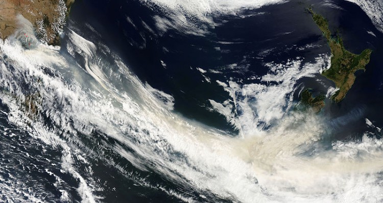
Satellite Image
This image shows the extent of smoke cover over Victoria and even as far a way as New Zealand, some 2162 kilometres (1343 miles) away.
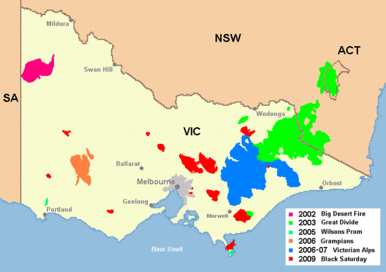
Map of significant fires in Victoria
This map below shows significant fires (including Black Saturday) that have burned in Victoria.

